Miller’s Landing Campground is situated on the historic Lowell Point homestead dating back to the 1950s, located just south of Seward at the gateway to Kenai Fjords National Park. Our RV and camping area has withstood fires, floods, and earthquakes and has transformed into a top-notch facility offering exceptional services including fishing, kayaking, and sightseeing tours customized to your preferences. Browse through our selection of maps of Miller’s Landing and the nearby areas, and click on the map to see a larger version.
General Area Maps
-
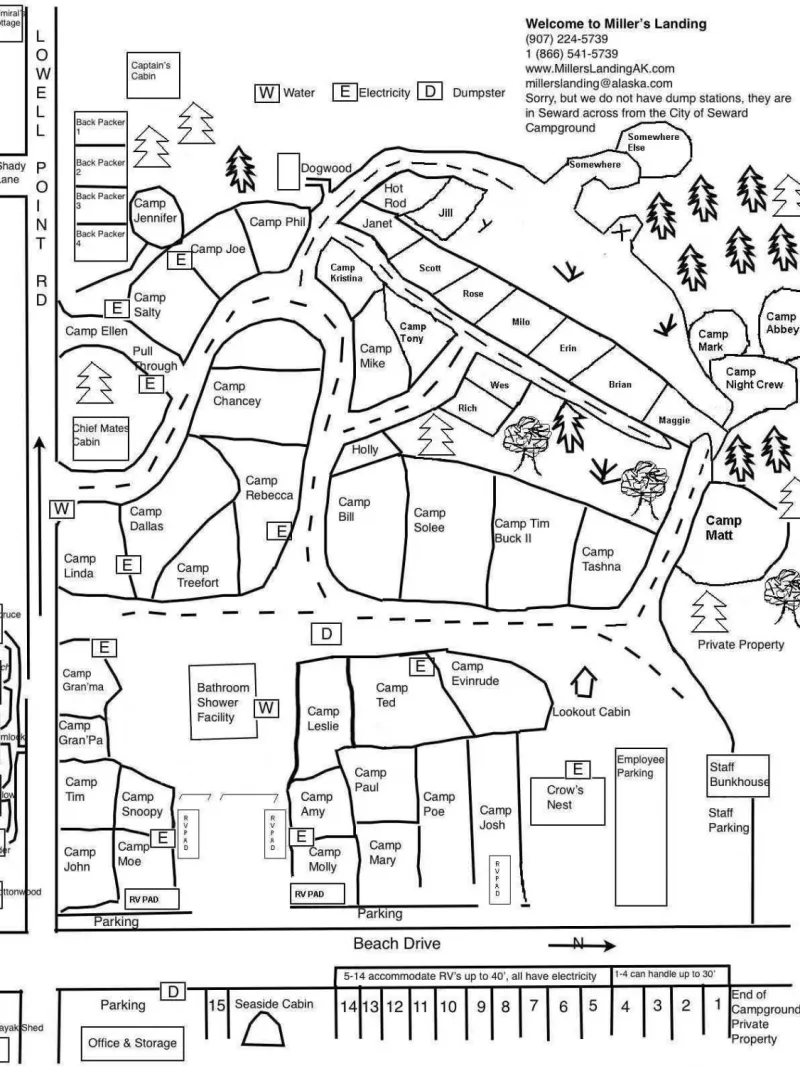
Updated for the 2023 season, this map includes the locations of all cabins, tent and RV sites in our main campground and Annex area. Oceanfront Inn properties are not depicted!
-
Resurrection Bay fresh waters are closed year-round to fishing for all salmon except the waters of Resurrection River downstream of the Seward Highway and Nash Road. In these waters open season for salmon (other than King salmon) is June 16-Dec. 31. Limit is 3 salmon per day, 3 in possession of which only 2 may be silver (Coho) salmon. Only unbaited, single-hook, artificial lures are allowed. * Seward Area “Youth-Only” Fisheries: Only open to anglers 15 years of age or younger • In the waters of First Lake, located in Seward, four consecutive days beginning the third Thursday in May (May 21-24, 2009) • The Seward Lagoon and lagoon outfall stream are open to King salmon fishing the third weekend of June (June 19-21, 2009), and the second weekend in July (July 10-12, 2009). It is open to silver salmon fishing the last weekend of August (August 28-30, 2009) and the first weekend in September (September 4-6, 2009). Single-hook, artificial lures and bait are legal. The bag and possession limit is two (2) fish. • The waters of the Seward Lagoon and outfall stream remain closed to all fishing the remainder of the year and closed to fishing for other species during these youth-only fisheries. Check with ADF&G for changes in regulations and happy fishing… Miller’s Landing 2009
-
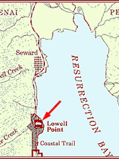
How to find Miller’s Landing Campgrounds: Miller’s Landing is located on Lowell Point, just 2 ½ miles south of Seward. It is situated on the oceanfront of Resurrection Bay on the Miller family homestead. It takes about ten minutes to drive to the town of Seward from Miller’s Landing or to the Small Boat Harbor. Driving from Anchorage or Kenai: Take the Seward Highway south, this turns into 3rd Ave in Seward. Go to the end of the road (you will be facing the SeaLife Center), make a right onto Railroad (it becomes Lowell Point Road). Drive 2½ miles along the waterfront (watch for sea lions and sea otters on this lovely drive) and you’ll run right into us on the beachfront! Physical Address: 13880 Beach Drive, Seward, AK 99664
-
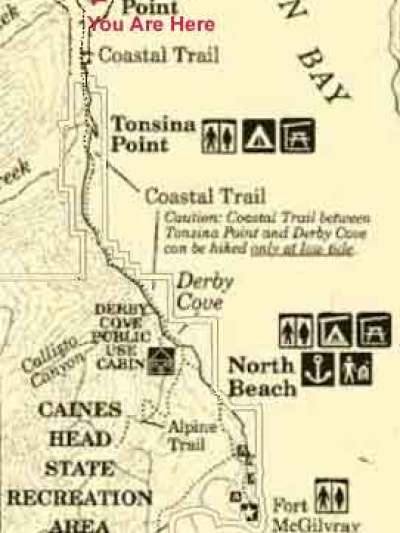
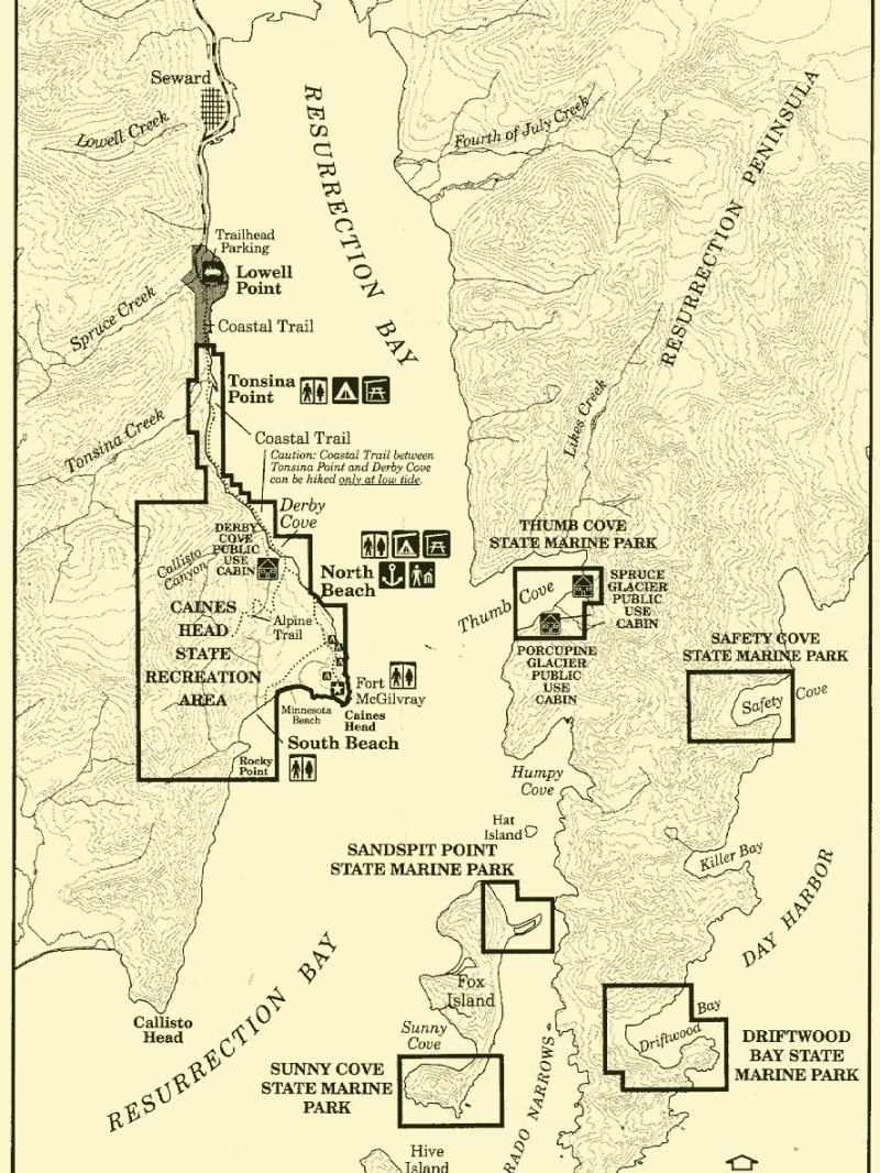
Easy to read map of trails from Lowell Point to Caines Head State Park Recreation Area.
-
Some of the Resurrection Bay Trails with access from Miller’s Landing
-
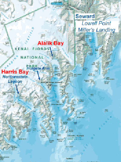
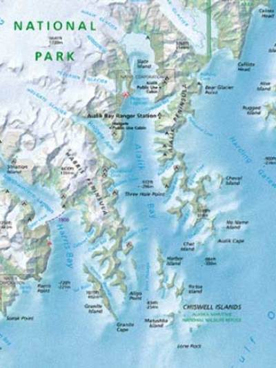
Medium map of Aialik Bay, Resurrection Bay and Harris Bay (Northwestern Glacier)
-
Larger map of Aialik Bay, Resurrection Bay and Harris Bay (Northwestern Glacier) Under Construction – will have Water Taxi destinations marked on it…
-
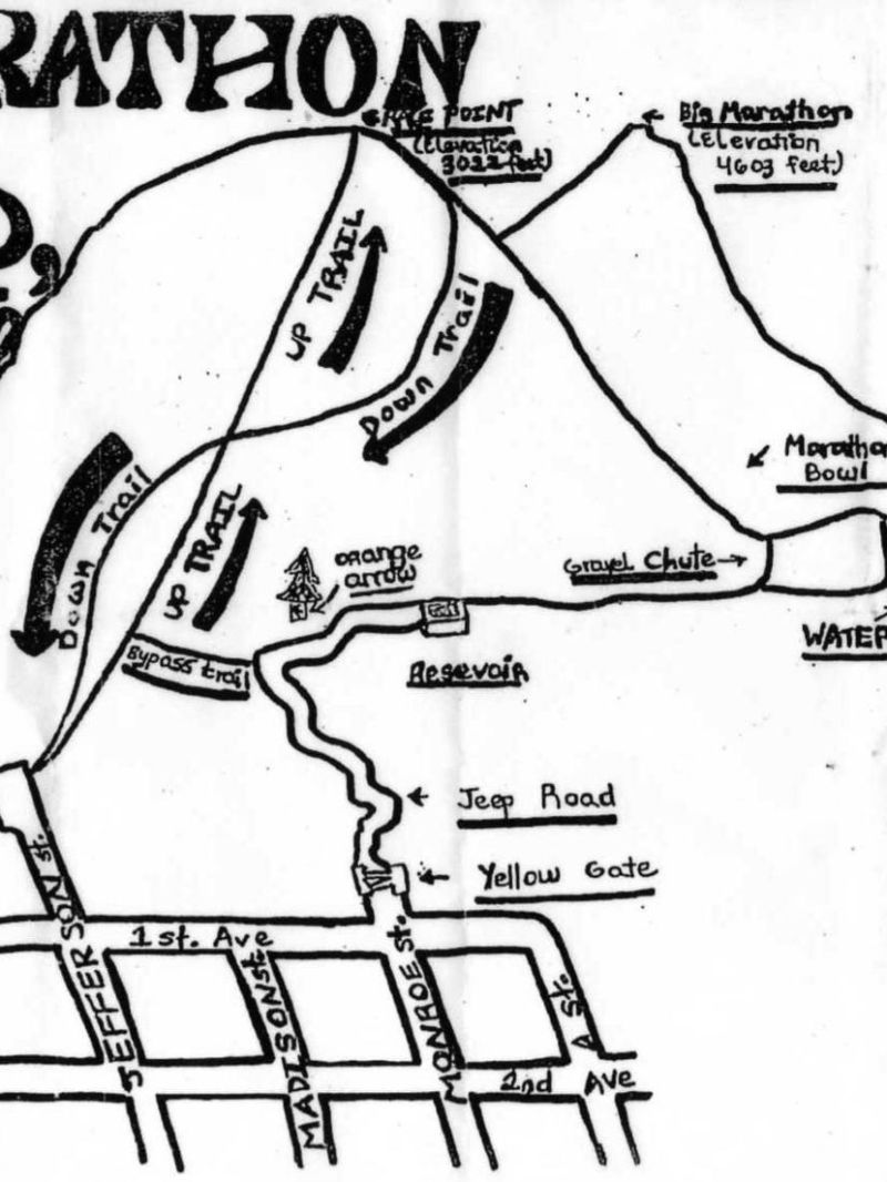
Easy to read map of the Mount Marathon maze of trails…
-
View all the hiking trails near Resurrection Bay.
Stocked Lakes Maps
-
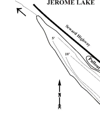
Mean Depth: 8.6′ Maximum Depth: 15′ Shoreline Length: .9 mi Surface Acres: 16 Acres Volume: 138 Acre Ft. Elevation: 1000′ Management Area: Kenai USGS Map: SE C-7 Jerome Lake is stocked annually, scheduled for stocking 2,100 rainbow trout fingerling in 2009 and 2011 and 1,600 rainbow trout fingerling in 2008, 2010, and 2012. Directions: Mile 38.6 Seward Hwy. (0.5mi north of Seward Hwy./Sterling Hwy. junction), within Chugach National Forest. Paved turnout west of highway. Steep bank to lake. NOTE: Please respect property. Keep lake and access sites free of litter. Species Present: Dolly Varden, Rainbow Trout First stocked in: 1962 Status: U.S. Forest Service Access: Foot Trail & Parking — Township: T5N, R2W, Sec. 2, 11 Lat/Long: 60° 32′ 43” N, 149° 34′ 22” W
-
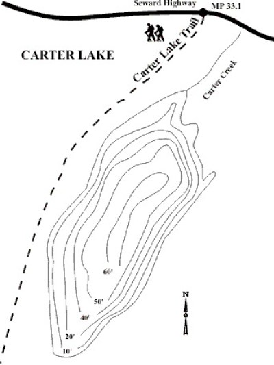
Mean Depth: 33′ Maximum Depth: 60′ Shoreline Length: 1.8 mi Surface Acres: 48 Acres Volume: 1610 Acre Ft. Elevation: 1486′ Management Area: Kenai USGS Map: SE B-7 Carter Lake is stocked on even years, scheduled for stocking 5,000 rainbow trout fingerling in 2008, 2010, and 2012. Directions: Walk-in lake at Mile 33 Seward Hwy., at Chugach National Forest trailhead with parking and toilet facilities. Well-developed but steep trail climbs 986 ft. in 2.0 miles. NOTE: Leave No Trace. Keep lake and access sites free of litter. Species Present: Rainbow Trout First stocked in: 1976 Status: U.S. Forest Service Access: Foot Trail & Parking — Township: T5N, R1W, Sec. 28, 33 Lat/Long: 60° 29′ 35” N, 149° 27′ 24” W
-
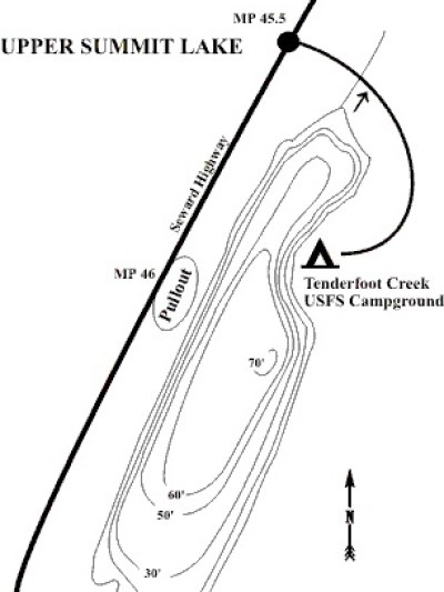
Mean Depth: 41.8′ Maximum Depth: 70′ Shoreline Length: 3.3 mi Surface Acres: 258 Acres Volume: 10729 Acre Ft. Elevation: 1300′ Management Area: Kenai USGS Map: SE C-7 Upper Summit Lake is stocked annually, scheduled for stocking 31,000 rainbow trout fingerling in 2008-2012. Directions: Mile 45.5 Seward Hwy. East side of highway paved turnout. Or Mile 46 Seward Hwy. East 0.6 mile to Tenderfoot Creek USFS campground with camping, water, toilets, dumpsters, tables, firepits and boat launch. NOTE: Please respect property. Leave No Trace. Keep lake and access sites free of litter. Species Present: Dolly Varden, Rainbow Trout First stocked in: 1962 Status: U.S. Forest Service Access: Boat Ramp & Parking — Township: T6N, R1W, Sec 5, 6, 7, 8 Lat/Long: 60° 35′ 54” N, 149° 32′ 28” W
Kenai Peninsula
-
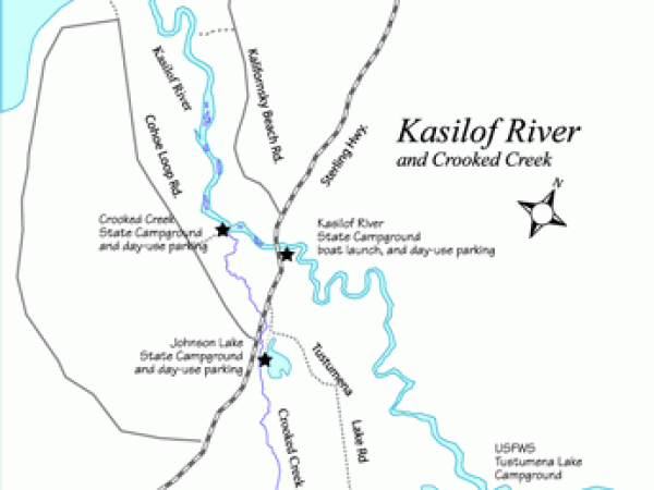
Map of Kasilof River and Crooked Creek as well as the surrounding area.
-
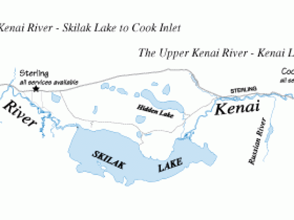
The middle and lower Kenai River draining into Skilak Lake to Cook Inlet.
